Here's the exact route we ran south from Dubuque to the Gateway Arch - tap any stop to open it in Google Maps. 🚐
Northeast Iowa
Dubuque, IA
Iowa's oldest river town - bluff-top views and the Fenelon Place cable car.
📍 Open in Maps
Field of Dreams Movie Site
Is this heaven? The actual 1989 movie field, still mowed and still magic.
📍 Open in Maps
Maquoketa Caves State Park
Iowa's wildest cave system - 13 caves you can walk, duck, and crawl through.
📍 Open in Maps
Cedar River / Iowa City
Palisades-Kepler State Park
Cedar River bluffs and limestone cliffs - easy hikes and a quiet paddle.
📍 Open in Maps
Devonian Fossil Gorge
A flood-scoured gorge where you walk a 375-million-year-old sea floor.
📍 Open in Maps
Quad Cities, IA
Iowa 80 - World's Largest Truckstop
The World's Largest Truckstop - trucking museum, chrome shop, roadside legend.
📍 Open in Maps
Davenport, IA
Quad Cities riverfront - riverboats, art, and skyline-bridge views.
📍 Open in Maps
Missouri
Hannibal, MO
Mark Twain's boyhood town - Tom Sawyer's cave and the real Mississippi.
📍 Open in Maps
St. Louis, MO
The Gateway Arch and the river's big-city finish.
📍 Open in Maps
📋 All 9 stops
Quick list — tap any to open in Google Maps.
- Dubuque, IA — Maps ↗
- Field of Dreams Movie Site — Maps ↗
- Maquoketa Caves State Park — Maps ↗
- Palisades-Kepler State Park — Maps ↗
- Devonian Fossil Gorge — Maps ↗
- Iowa 80 - World's Largest Truckstop — Maps ↗
- Davenport, IA — Maps ↗
- Hannibal, MO — Maps ↗
- St. Louis, MO — Maps ↗
Take this route with you
Want this route on paper? Print it and keep it in the rig.
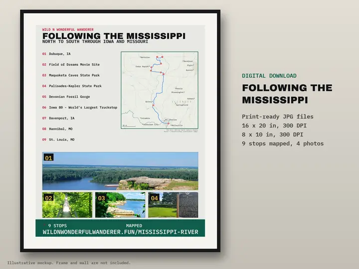
Illustrative mockup. Frame and wall are not included.
Following the Mississippi — Iowa & Missouri
9 stops numbered on one map poster. Digital download: print-ready JPGs at 16×20 and 8×10 in, 300 DPI. Nothing is shipped.
Printable route map — $12
